Where in the hell am I?

Stories from the road, and home, by a contract archaeologist.

My Photo
Name:
Location: Texas, United States

I work out of town a lot as a contract archaeologist. Sometimes it's interesting. It can be quite funny, although probably only to other archys. Home is Austin, with my wife and our cute kitty and all of our crazy friends.

Wednesday, January 21, 2009

Look, it's a site!

That's me sitting on a nice sandy ridge that surely contains some awesome buried deposits related to site 16DS277. The photo was taken from the pipeline corridor, in the location that the site was originally documented. The recorder noted that the site likely continued onto this nice ridge, however, he was limited by the APE. One of our primary goals during the survey in Louisiana was to try and ground truth the site boundaries for the potentially significant sites. Many recorded sites have indeterminate boundaries because of the survey limits, but this isn't necessarily reflected on the topographic quad maps that are used by state agencies to record site locations.
In our case, our main limitation as far as chasing sites was the property boundaries and permitted areas. However, the restriction placed by the "no shovel test" rule, combined with the thick pine needle and oak leaf litter ground cover, meant that we couldn't really ground truth sites very well. This site was an exception because, as you see, it's been cleared and is used as pasture. In the background, however, you will notice a wall of short trees that is a pine timber farm. The site likely extends back there as well, as the ridge continues, but we had zero visibility. I used the fence line as my new site boundary on the GPS.
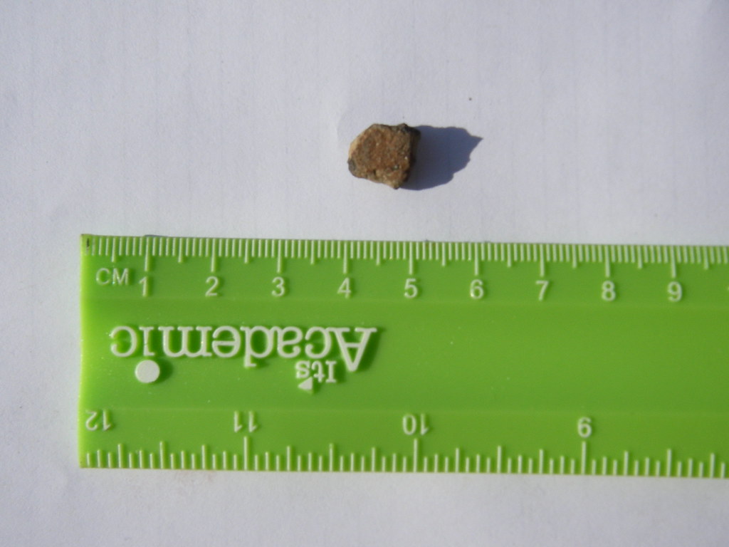
We actually found some artifacts here as well (photos on the Flickr page or just click below). The area along the fence line had undergone some erosion, which left a narrow linear exposure. I found a small, brushed, sand-tempered ceramic sherd and a tested petrified wood cobble in this area. There were also extensive gopher mounds on the ridge, and I found a grog-tempered, incised ceramic sherd on one of those. That doubled the artifact count from the week of survey.
Last Friday ended up being the last field day, due to limited access to two of our HPAs and two of our sites. We even got done a little early and grabbed some lunch at a gas station/cafe in Keatchie (rhymes with Peach Guy). The lady at the cash register asked if we were with the pipeline, and I told her that we were with the seismic survey. She replied, "Oh, the intellectuals" and laughed, and I smiled and nodded. She mentioned that they were glad to have us out there, because we were helping a lot of people out. That made me feel really good after all of the other nonsense involving landowners.

On a totally unrelated note, I was looking at a link on Colleen's awesome blog (and if you read mine, you probably already read hers, and probably read it first. If you don't, read it because she's out on the academic forefront of archaeology and technology). Turns out that I made a Top 100 Anthro Blog list. I'm sometimes interesting! I'm inclined to agree. Thanks for the kudos!
Labels: , , , , , ,

Thursday, January 15, 2009

There will be blood

Surveying always means lots of scratches and cuts. You're dealing with briar, barbed wire, cactus, mesquite, juniper, (insert your own regional thorny thing here), etc. I have a scratch on my stomach from something that passed through four layers of clothing.
But I have never had a field nick that bled like the one I currently have on my neck. It is the tiniest little puncture wound you can imagine. The scab is about the size of a poppy seed. But I guess it's right on top of a major artery, because when it comes off the blood literally runs down my neck. I've had much larger, more painful cuts that haven't bled a tenth of what this little prick will.
Speaking of "These things will happen", that was precisely the response I got for the land agent and the drill crew project manager about our landowner incidents. I was stunned, until the drill crew guy followed it up with, "Well, it's was not the fault of anyone in this office."
I now know the sound of six jaws dropping simultaneously.
It was truly amazing how minor they seemed to think the situation was, and how pissed off they seemed to be that we were making a big deal out of it. What made me angrier still was that I was in part trying to do them a favor by making them aware of potential access issues. I was also legitimately concerned for the safety of my crew. Their guys are out on humongous drill trucks. We're out walking around. The landowners know that there will be huge trucks rumbling on their land at some point, but probably aren't expecting 2-3 people in safety vests out on the back forty.
Anyway, I went in after a short field day yesterday and found someone who would help me, and got all the information I'd asked for on Monday morning (and should have had before then) within an hour. Now I know every property ID, and the permit status of every property as of January 14th, and have it on a map. This doesn't mean more incidents won't happen, but I've now made every effort to get the permit information to the land agent...so next time, there's no way it's our fault. Plus, we're almost done.

Labels: , , , ,

Tuesday, January 13, 2009

With great responsibility...

These last two days have been a heaping spoonful of what it's like to be field director. All of the times that I said to someone, "I'm sorry you have to deal with that, but I'm glad it's not me" are coming back to haunt me.
Yesterday, we met with our client's field rep, the drill crew project manager, and a land agent for almost 2 hours. I don't think the crew minded too much, as they got to sit in an office and read. I had to try and figure out what info the other people wanted, then try and find it, and try and get some things I needed from them, all while making sure I didn't say anything to make things even more difficult. Eventually, they gave me a map with all of the property tracts on it, with markings to distinguish between "clear" and "not clear" properties. This way, we wouldn't be trespassing. Last night, I spent a good two to three hours marking all of our field maps with permanent marker to make sure that the no access properties were obvious.
So today, I send out one of my crews to revisit three previously recorded sites while I took a crew to an HPA that was near the drilling. Before we left the field office, we talked with our land agent who said everything was good. At the very first site, the crew was met by an unhappy landowner, who told them that his access was on a "pay-per-entry" basis and that the land agents knew that. He wasn't angry with them, but all the same, they were asked to leave, but not before he told them about all the stuff he had found. I had them call the land agent to tell him the situation.
After revisiting the second site, they drove to the third site, which had limited access. I had them call the land agent to check on possible access roads, since they would be crossing an area that wasn't marked on the field map. Apparently, they talked to a different agent as our guy was out on another job! That person told them to follow a gated driveway that became a farm road. As they're at the gate, the landowner drove up and was very unhappy. Apparently, he's never been paid for the access he granted, and was supposed to have been paid in November. Again, he wasn't really angry at the crew, just at the project (not sure who is in charge of that aspect). Eventually, he even allowed them to survey the site area, but also told them to pass the word along that there would be no more access until he got paid.
So, work an eight-hour day that involves walking for miles and looking for sites while NOT digging shovel tests in meter-plus deep sandy soils beneath 5-10 centimeters of pine needles and leaf litter (as we say "looking for a piece of hay in a needle stack"). Then, come home and put out small fires and apologize to crew members who got yelled at TWICE and let the clients know what we did today and plan out the next days work. Yeah, I have time to blog about it, but it's exhausting!
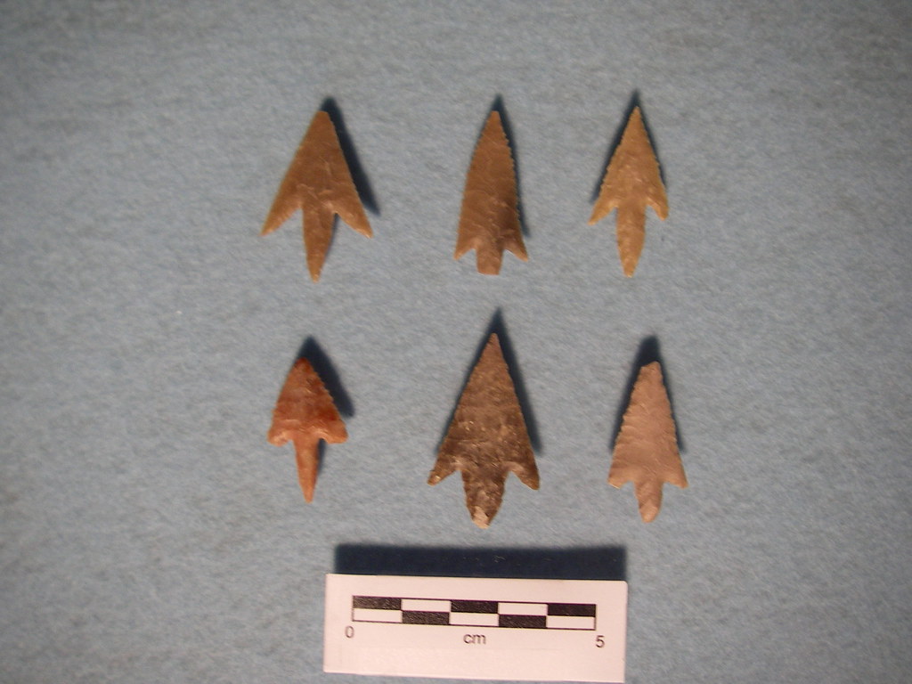
On the plus side, I did actually find a pretty nice dart point base in a dirt road.

Labels: , , , , ,

Sunday, January 11, 2009

Another state of mind

So I drove up to Shreveport, Louisiana today for a weeklong reconnaissance survey project. This is my first time actually doing fieldwork in Louisiana, although I've been to Baton Rouge a couple of times to do background research.
Not only is this my first time working in Louisiana, but I am actually the field director for this job, overseeing 5 crew members. This is my first time as a field director, so I'm a little nervous. OK, very nervous, as this is something of a test. This isn't exactly a normal project, although now that I think about it I'm not exactly sure what a normal project is. It's going to require a lot of flexibility and improvisation. Fortunately, the months spent on the Keystone pipeline project definitely required plenty of those things.
The work is being done for a seismic survey. Their project area is 165,000 acres. We did a background review which identified all of the previously recorded sites in the area. We also identified the High Probability Areas based on the sites, soils, geology and drainages in the area. We gave this to the client to develop an avoidance plan. Unfortunately, there were still 20,000+ acres of HPA, which was too much for the client to avoid impacts, and too big to survey effectively. The Louisiana SHPO wasn't very specific about what to do, so we worked with the client to develop a workable plan. We identified 10 areas within the HPAs that had the highest probability of having significant sites (basically, the areas most likely to have Caddo sites), and will survey those. We will also revisit the potentially significant previously recorded sites to make sure that the recorded site boundaries are correct, to assist in avoidance.
Now, the kicker. There's some obstructionist contractors (I guess with at least some say over how work is conducted) who have been very difficult. They freaked out at the idea of shovel testing. I don't exactly understand why, something about landowners withdrawing their access (I can't remember if I've blogged before about landowners misunderstanding of cultural resources laws, who fear that the government will take their land if we find a site). So we're not doing any shovel tests, only examining ground surface and exposures. They also are uncomfortable with the concept of the HPAs. However, somehow, they were cool with everything when it was explained as "places where sites were found but not properly recorded." So that's how we're selling that.
Honestly, this isn't really how cultural resources management should be done, and none of us are really comfortable with the process. On the other hand, it makes for very easy field work if one can compartmentalize and look at it as "At least we're doing something."
Oh, last thing to mention before I turn in for the night. Almost all of this has happened (except the original background review and avoidance plan) since last Wednesday.

Labels: , , ,

Tuesday, December 16, 2008

A first for me

Today, after multiple false starts trying to get a backhoe out to our survey area (much of which was badly rutted and partly underwater), we finally used a roundabout way to get to a nice upland ridge overlooking a creek. Theoretically, this area had already been surveyed and would not have such deep deposits that a backhoe was required (basically, a shovel test can only get you about a meter below the surface). But, it was a nice spot and it was actually dry, unlike the floodplains. SO I have our driver pop in a backhoe trench. It has about 60-70 centimeters of a nice brown sandy loam, and then a very strong yellowish-red clay layer (which would be very old and predating the presence of humans in Texas or the Americas). I'm out there partly to show a bunch of newbies and rusties how we examine and record a backhoe trench. So I start cleaning an area of the trench wall with a shovel, showing the actual clean profile. I go over the different strats and call out depths and such.
Then I start cleaning the whole trench wall. You're pretty much supposed to do this anyway, but depending on time considerations and probabilities and such, I don't always do this. Nothing was obvious in the backdirt and there was nothing in the small area I had cleared. Plus, it had already been surveyed.
As I'm going along, having cleared maybe another foot of wall, I see a cool ferrous concretion in the wall and try to knock it out. When I bend over to try and find it, I notice a piece of what looks like chert sitting on top of the dirt I had just cleared off the wall. "Interesting," I thought and take a look at what I figured was a small gravel. I realize it's an artifact of some kind, look at it again, and "Holy shit, I just found a point!" It's an ugly little Gary point, but it counts. I've never found a point in a backhoe trench (or a shovel test) that was not on a known site. Plus, I had eight people watching when it happened.
We end up doing another trench and a series of shovel tests, mostly just trying to find the site boundaries. We also did a column sample (a small test unit) on the original trench and screened the trench backdirt. All in all, we found 6 more flakes in the original trench, had 3 positive shovel tests that found 4 more flakes, 3 pieces of prehistoric pottery, and a possible point base. I also found 3 more pieces of pottery in a gopher mound, including an incised sherd and a very nice rim sherd. It ended up being a decent site, and we've recommended avoidance due to potentially significant, intact deposits.
So yesterday I talk about the high possiblity area, and sure enough, it produced! It took some looking, but it was there alright. It made up for the freezing mist we had to work in all day.
Tomorrow we head to the South Sulphur River for more backhoe trenching. We're also going to do some more shovel testing on a very large Caddo site that was found earlier this year. It's a lot of hard work, but it's really exciting! I'll try and post some pictures tomorrow.

Labels: , , , , , ,

Monday, December 15, 2008

Baby, it's cold outside!

People sometimes wonder why we do so much of our archaeological work in the summer here in Texas, where it's regularly over 100 degrees and often 80+% humidity. I've been known to gripe about it myself from time to time, when I'm covered in Ivy Block, sun screen, long pants and a long sleeved shirt walking through greenbriar and sweating my ass off.
Well, right now it's about 20 degrees outside in Tyler, Texas. I drove up here today from Austin, where the temperature dropped from 68 degrees at 10pm to 40 degrees at 10 am. The crews here were working in far northeast Texas, near Paris, where they had to deal with sleet and freezing rain and weather in the high 20s. The trucks still have some ice on them. Tomorrow promises to be just about as cold, and I can only hope it stays dry.
On the plus side, the poison ivy is dead, the snakes are hibernating, most of the vegetation is brown and dry (although the greenbriar is still green and sharp). And we're digging backhoe trenches in some of the highest probability areas we've had on this whole project, right in the western part of the Caddo heartland. One of the crews delineated a site today that included an incised ceramic sherd, which is almost definitely a Caddo artifact.
All the same, I'm going to be wrapped in layers of all my warmest field clothes! I bought a lot of stuff at the REI clearance last year for just such an occasion.

Labels: , , , , ,

Wednesday, December 03, 2008

I walk the line again

Well, sort of. So far I've done some backhoe trenching and some access roads. It's not like the early days in Oklahoma, but somehow it still has been leading to 11 hour days including the post-field work. It seems like there's twice as many forms now, although it's really just that crew chiefs are now doing some of the paperwork that the field director was doing for us before.
Yesterday, I got to be an official Competent Person for the trench excavations, even though I haven't gotten my certificate yet (and I'm really excited about it). I used the tensometer and rated the soils and everything. It really isn't all that exciting. Mostly, as I may have said elsewhere, we've lost our plausible deniability because we know all of the safety issues and standards involved in open excavations.
I haven't seen any Caddo stuff yet, although we're in the Caddo area of Texas. In fact, there's been no cultural materials for my crew so far. Just a lot of walking and driving, and paperwork. Tomorrow will be more of the same, across three counties.
On the other hand, I'm almost in to overtime already, and it beats being in the office! Plus, the hotel room has an LCD TV and lots of cable.

Labels: , , , ,

Monday, November 17, 2008

What's the point?

So I've spent the better part of the last two weeks at work analyzing projectile points from the Siren site in Williamson County. These are what are commonly referred to as arrowheads. However, while all arrowheads are projectile points, not all projectile points are arrowheads. Until around 600AD in Texas (give or take, and the numbers have been moving older) projectiles were darts, thrown with an atlatl. Then, the bow and arrow technology was introduced and adopted (some say rapidly, some say gradually).
On a tangent, not all projectile points are really projectile points either, as usewear studies have shown that many points were either also used as cutting tool, or only used as cutting tools.
Back to the point (sadly, pun intended), my analysis is partly quantitative (a number of standard dimension metrics) and partly qualitative. This includes things like trying to determine if the point has been thermally altered, and if so, was it intentional. That one is pretty easy, and the most common chert from the site takes on a very distinctive color and lustre and a waxy feel when it's been intentionally heat treated. Other elements include reworking (basically, rejuvenating a worn or broken tool), beveling (which is often a sign of reworking), location of notches, and type of shoulder. In some cases, like basal margin, options include "shallow concave" and "deep concave", with no set definition of the distinction. Since I'm still a relatively junior lithic analyst, this can be hard and at times a bit frustrating. I'm proud that my bosses think I'm capable of this level of work, but I'm still afraid sometimes that I'm doing things wrong. On the other hand, I've already been told that there's not exactly one right way and that 5 different people will look at the same point as many as 5 different ways.
Right now, I've been working on the dart points (although I did change one to an arrow point). I'm about to get into the "Untyped" category, which means I get a crack at trying to identify them as well as analyze them. Nothing like questioning your superiors! Then, the arrowpoints. There's somewhere between 250-300 total points, and I've analyzed 190-odd so far. After that, the 500+ bifaces. And maybe, just maybe, I'll get to spend some time in the field again!

Labels: , , , ,

Monday, November 03, 2008

The TAS meetings

So I said I would blog about this, and it's been a couple weeks. There's nothing else going on in the world, right?
The drive up was eventful. We took SH 71 for the first part, which takes you through Llano. So we get to the bridge across the Llano River, and there's a few emergency vehicles blocking the bridge and diverting traffic. We get close and I notice there's a woman standing on the wrong side of the bridge, and two men are talking to her. We ask the cop if there's another way across the river, and he says "Bridge is closed, you'll have to wait." This is only an hour or so into a 6 hour drive, so waiting was not on our minds. We pulled out our atlas and found a way across. It turned out to be an absolutely amazing road that takes you on this little bridge/low-water crossing west of town. Basically, take RM 152 west until you hit County Road 102. Turn right on CR 102, and that'll take you across the river.
I'll also say that the climb up onto the Llano Estacado through the Caprock Canyonlands was pretty beautiful also. We also got to see some of the wind turbines we surveyed for south of Sweetwater.
Once in Lubbock, we check into the hotel and start drinking, first in our room and then at the hotel bar. Again, this was an archaeological conference, so that's where the action was as far as networking and catching up was. Also checked into the book room and the silent auction room. I picked up a couple of older journals with classic articles. Tina bought a book on cannibalism and got some earrings at the silent auction.
Saturday I caught a few papers. One was by someone I worked with this summer, and it was a good talk. A couple were by my bosses, presenting the final results of the analysis from the dig in Kerrville back in 2004. The wheels of archaeology turn slow! One interesting paper was about a possible source of tektites around Cuero. I think I might have blogged about tektites in Texas before. What was interesting about this was that the dates from the source in Cuero are not the dates for the known strewn field in Texas that is a result of the meteor that created a huge creater in the Chesapeake Bay.
Two other papers have some relations to work I've done or will be doing soon.
One was an experimental archaeological project testing the ability of a bow and arrow to penetrate a medium (deer) or large (bison) animal. They tested 3 different weights of projectile points and 3 different amounts of force, and found that a single hunter would require a relatively heavy projectile being shot with a lot of force to kill a deer with a typical prehistoric Texas bow and arrow, from a set distance. This suggests that in order to kill larger animals (like bison), various hunting strategies would have been necessary. The Perdiz point is associated with large-scale hunting of bison in Texas from 1300AD to 1600AD (known as the Toyah phase), and at the site we dug in Junction we focused on the Toyah phase occupation(s). Pretty soon, I'll be doing the metrics and analyzing the artifacts from that site.
The other paper had to do with tool-stone associated with a specific geologic formation that stretches across parts of Northern Texas and Central Oklahoma. This formation (the Antlers Formation, and I couldn't find any really good links on Google) was actually once the ancient shoreline of North America, hundreds of millions of years ago. The huge Keystone pipeline survey crossed a portion of this formation, and we had a string of sites with lots of lithic artifacts in this area.
So yeah, I got to drink a lot of beer, meet some new people and catch up with some old friends, and I learned stuff! I also found out that Lubbock is really boring and ate almost no vegetables all weekend.

Labels: , , , , ,

Tuesday, October 14, 2008

Evaluating impacts

It's kind of funny to be spending my week looking at bridges that are to be replaced and evaluating the potential for archaeological deposits within the area of potential effects (APE)(which we never say as "ape" but as a.p.e.). In some ways, it's what some would call a reconnaissance survey, where you don't dig but merely inspect the ground surface for artifacts. But in a lot of states, that's pretty much all one does. If there's enough stuff and it looks like there might be features, then you go to test excavations. In our case, even if we don't see artifacts, that doesn't mean that the work is done. We also have to assess the area for levels of disturbance, soils, and other factors that would preclude the APE having the potential for buried archaeological deposits. Ideally, intact, significant archaeological deposits but that's a little more difficult to assess.
Today, for example, we examined three bridges at tributaries or back/flood channels of the Colorado River, in Matagorda County. Two of them were basically built on floodplains with extensive wetland areas, and the entire APE, which consists of the existing highway right-of-way (ROW, which we do say as "row"), was built entirely on imported roadfill. This is to avoid flooding of the roadway. In these cases, it's easy to say "There is no potential for the APE to contain intact archaeological deposits." It's as much as 12 feet of road fill, and the surrounding area is basically marshland and not a preferred setting for human settlement (Western Louisiana not withstanding). One of the crossings, however, crossed a relict terrace of the Colorado River and was situated well above the drainage floodplain. Furthermore, the portion of the road on this terrace did not have a major fill section (it's basically above the normal high water mark). Finally, the ROW was pretty wide in this area, meaning that some portion of the ROW appeared to be intact natural soils that had not been totally disturbed by road construction. Of course, it was blanketed in poison ivy, so I couldn't really examine the ground surface for artifacts. But in my report, I'll have to say that at least a small portion of that bridge project contains at least some potential for buried cultural materials. It's up to the client whether to have a survey done on this minor area or recommend that construction activities in this area avoid the potentially intact ground.
Reading that is about as exciting as doing it, but I've gotten to see a lot of new parts of southeast Texas, for better or worse.

Labels: , , , , , , ,

Thursday, October 09, 2008

Writing and editing and grey literature

But really, there hasn't been much exciting archaeological stuff going on in my life. I've been spending much of my time editing our huge Oklahoma survey report. Basically, this entailed addressing the comments that the client's lead archaeologists made, and accepting or rejecting their changes. It actually took a really long time, because the readers had a lot of comments and changes. Among other things, some of the actual project terminology changed after the draft report was written, and so every instance of that was changed. Apparently, "corridor" is a big no-no in the world of pipelines. There is also the matter of one of the readers basically rewriting huge sections of the results chapter and getting the information wrong. She also isn't the strongest writer in the world, and she uses some archaic grammatical rules as well.
I've actually been asked to edit reports a lot recently. I was editor for the entertainment section of the UT newspaper years ago, and I guess I still have some of that in me. I hate run-on sentences (well, at least in professional reports). I don't like when sentences are split. In some of our reports, this happens frequently (note: that was an example). I'm also not a big fan of starting sentences with "Also", "In addition", or "However".
During my time at TxDOT, I got to read a ton of reports, from small surveys to large, multi-volume excavation reports. It's amazing how many of them are poorly written and edited, particularly since many of them are authored by people with graduate degrees. My company's reports are better than most, although we've had some people (who are no longer with us) who made me cringe.
I think it's important for the grey literature of archaeology to be more widely read and distributed. At the same time, I'm not sure that much of it is ready for widespread scrutiny.

On a tangentially related note, I've received my diploma. My thesis is also listed in the UT Library Online Catalog.

Labels: , ,

Friday, July 25, 2008

Back!

And it's no secret. I was tooling around the Hill Country the last couple of days, staying in hotels which did not have internet access (which wouldn't bother John McCain, as he doesn't use computers), eating lots of good homestyle food. We lost a few hours yesterday to Hurricane Dolly, which basically had one of it's massive bands of rain going over Bandera County for hours and hours.
By the way, if you haven't been to Bandera County, it's absolutely beautiful. I think Bandera is a pretty fun little town to stay in, as they try and maintain a sort of outlaw country feel to the place. Today we were surveying around Tarpley, which has some really great hill peaks to go with the regular stunning hill country scenery. We also found a pretty cool little site there.
Anyhow, I ended up working a few extra hours this week, and since there's not overtime for this job, I can pool my hours for next week. I know it's not exactly right or fair, but that's how it is. So I'll be able to take a day off next week (after working a few more hours tomorrow to wrap stuff up) and finish the thesis. This weekend is pretty much out as Tina is finally back from East Texas and I'm going to hang out with friends I haven't seen for a while. And, at some point, add some entries to the food blog.

Labels: , , , ,

Monday, July 21, 2008

Laying low

So I've secretly (or maybe not) been back in Austin since last Wednesday afternoon. I've been pretty much a home/workbody since then, with a couple of exceptions. I went to a "last day of work" Happy Hour for my friend Carolyn, and a housewarming party for my friends Shelly and Kirsten (all of the above are fellow archaeologists and/or archaeology students). I also went to lunch with Carolyn at Roaring Fork (good, but pricy) to help her rate the food for a restaurant review. Other than that (and I guess it sounds like a lot), I've only been out to do errands.
I'm not really used to being in the afternoon heat. I know it sounds funny with my job and all, but we were working really early so that we could be done by 3 at the latest (with a couple of exceptions), and the time in East Texas was marked by even earlier departures most days. By the time the full heat of the day was in effect, I was in a hotel room, showered, drinking beer and working on paperwork or watching TV. I guess it makes sense that even though I'm here now, that's all I pretty much want to do after work as well. The a/c in my car also needs a tuneup, so it's almost unbearably hot being in there unless I'm on the highway. I guess I should take it in.
I can't say that I've gotten much accomplished besides some cleaning, some laundry, and getting through most of a tremendous backlog of magazines. I listened to some of the albums I bought when I was here last. I've given my cat a lot of attention, although I still don't know that it's enough for her or that it makes up for all the time I've been gone.
Tonight, though, I got to a point where the ennui was getting stifling and I realized I need to get my shit together because time is getting tight for the thesis. One good thing about the housewarming was talking with people who worked on the project and have worked there since. Not only did I get a chance to share some ideas, but I also learned that my understanding of the location of some of the later excavations was not correct. Now I have a chance to fix that before I submit the draft, and it doesn't really affect my argument at all. (EDIT: I just looked and I actually had it right already!)
Wednesday I get to go survey in the Hill Country for a couple of days. Wednesday night we stay in Comfort (Texas, that is), and Thursday is Bandera, which is a pretty cool little town. Even if it's hot (and restricted to the side of the highway right-of-way), I'll always enjoy getting paid to hike around the Hill Country.
So where in the hell am I? Austin, by god, Texas, sitting at my desk with my kitty curled up in the spot she sits while I'm writing on the computer, listening to classical music and eating ginger snaps.

Labels: , , , , , , ,

Monday, July 07, 2008

Oh, Beaumont

How I missed thee so...
Today we tried to go into the field, but the GPS machines weren't set up right. Normally, this would be something to freak out about, but for this project, it's just another typical snafu, in the true sense of the word.
Tomorrow, my crew is doing a section in Port Arthur, pretty much right at the end of the 1250 mile pipeline. The civil survey crew apparently spotted some gators on our line, which makes things, um, interesting I guess?
Beaumont has a nice, big HEB Plus. I couldn't understand a damn thing the checkout people were saying to me, but the store was pretty nice. It also has a lot of fast food places but not many local joints that we could find. It also has one of the worst Mexican food restaurants I've ever had the misfortune of eating at. I'll write about that on the food blog sometime in the next couple days. I have to start winding down since we're leaving for a safety meeting at 6:15 am.

Labels: , , , ,

Thursday, June 19, 2008

Lots of walking today

Generally speaking, Oklahoma is very linear. There are county roads running north to south and east to west almost every mile. When you are doing a very long linear survey, this is helpful. You can break your survey stretches up into small, manageable chunks and often arrange it so that you are always walking towards an awaiting vehicle. Sometimes, there's creeks that are impassable or reticent landowners and you have to do a "walk-in, walk-out".
Today, there were simply no roads. It was a stretch leading up to the Little River (and yes, some of us older folks made Little River Band jokes, and coincidentally, they played a show at a casino here last week!) across a stretch without all the county roads. Because of access issues, the nearest entry point was about 2.8 miles along the pipeline route from the Little River. We were able to score a ride on an ATV part of the way with one of the civil survey crews (they basically stake the line), but it wasn't quite half way there. My crew was chosen to walk the rest of the way to the river, THEN turn around and start surveying back. We would meet up somewhere in the middle with a second crew who was surveying towards us from the drop-off point. A third (very lucky) crew got to survey to the road from the drop-off point.
So, in summary, get dropped off and then walk almost a mile and a half to the river. Start surveying. When you meet the other crew, walk the rest of the distance back to the road. Total miles covered: roughly 4.3. Actual miles surveyed by my crew: .6. Oh yeah, and it was in an undulating terrains, which means lots of little up and downs into creek tributaries. And the grass was knee-to-waist high.
We did find a site, pretty much where we expected one to be. Nothing exciting, just a bunch of flakes and a bit of burned sandstone. It almost made up for the hike.
The amazing thing is that we covered all this terrain in around 5.5 hours of actual field time. We actually got done early, and decided to just call it a day. Tonight we're having a full crew dinner at a BBQ joint, then tomorrow we're moving down to Durant for the final stretch.

Oh, I do have to add...I did almost ask my boss to "Take it Easy on Me"

Labels: , , , , ,

Tuesday, June 17, 2008

Another rain day

It rained here in Ada (and central OK in general) all morning. It's clearing up now, but it was pouring for a while so we scrapped going out for the day. Too bad, as it's in the mid-60s outside. If we can make it through the rest of the day with no rain, it may be a pleasant day for survey tomorrow.
Considering the crazy weather of the last couple of months, the fact that we've only lost 2.5 days of work to rain over a month is really good. With the exception of last Monday and today, the worst storms either dodge us or pass through in the night.
Spent most of last week in Austin, sweating my butt off and spending money like a sailor on leave. Got to hang out with a lot of people, which was very nice. I also saw Afrika Bambataa at my friend's record store! And ate breakfast tacos on more than one occasion.
The Oklahoma survey is proceeding rapidly. We've made it up to milepost 110 out of a total 158. Of course, there are a number of gaps in there where the landowners have denied access, but we've still surveyed at least 80 total miles. After this week, they're probably going to reduce our group by one full crew. We have a couple of people leaving for field school in Belize, so it really only means that one crew member and one crew chief will be leaving, and there's plenty of other work waiting at the office. If I'm sent home, I'll probably be in Louisiana before too long, wading through the bayou.
Now, to work on my thesis for a while.

Labels: , , , ,

Thursday, June 05, 2008

Movin' on up!

Tonight is the last night in Stroud. We're driving almost 50 miles to get to our survey area right now, which means that 2 hours each day is devoted to drive time. So we're moving down to Ada, which is pretty well centered for the next 50 miles or so of survey. It's also a much bigger town, with a movie theater very close to the hotel. We'll also have microwaves and refrigerators, which means I can get a little bit closer to my regular dietary routine.
I did find out something interesting about Stroud tonight. There's a huge concrete foundation behind our hotel, just up a small hill. It's visible on Google Maps. Apparently, this was the location of a huge outlet mall which was completely flattened by tornado some years back. There've been a number of tornado watches and warnings north and west of here the last few weeks, and the tornado watch siren went off the second or third night we were here. I know this has already been a crazy year for severe weather (Bruce Sterling's Heavy Weather, maybe?), and Oklahoma seems to be right in the path of it all. So maybe there's another positive to moving 60 miles to the south.
We found a site today, by Wewoka Creek. Not sure how big it is yet, so far it's just two surface finds and a positive shovel test on a nice little sandy rise. I didn't see the whole shovel test, as I was setting up other people's spots, but there was apparently a lot of burned sandstone at one point, suggesting there may be a hearth or other burned rock feature. I don't know how much of it we'll dig up, though, probably just enough to know the site extents and whether it's significant enough to avoid. Such is the nature of most pipeline surveys.
Not much else is new. Still lots of ticks and poison ivy out there. Saw some deer today. Oh yeah, I also put some new pictures up on Flickr, including a great portrait of me in action.

Labels: , , , , ,

Tuesday, June 03, 2008

Survey machines

Today my crew covered 3.5 miles, AND we finished early. Most of it was through hayfields and pastures, and we only needed a few shovel tests each mile. Best of all, we didn't find anything. I know that sounds funny coming from an archaeologist, but some days you'd rather find nothing instead of having to spend a lot of time recording a minor trash scatter (or even a non-diagnostic prehistoric lithic scatter).
Yesterday, we did go back and record the two sites we found on Saturday. One of them was nothing, and I would have been okay to just call it a mistake, as the artifacts were questionable, but we had forms started and then someone found some historic glass nearby and so we had to go through with it. The site closer to the river was better, as we turned up a couple more chipped stone tools (nothing too nice and not diagnostic) and a couple of groundstone tools as well. Still not a major site, but it was a nice change of pace.
The other crew found a late-19th and early 20th century cemetery. It was covered in brush and poison ivy and had apparently been partially bulldozed. It's possible that there's more burial than there are markers left. I also heard it may be Native American, but I really don't know, as it wasn't on one of our stretches.
Tomorrow we've got a major challenge. My crew is going out on a one-mile stretch with a crew of biologists and one of the general survey crews. We only have access to this for one day, so if we find any sites, we have to record them and keep going. It's also a walk-in, walk-out, so that it's actually a two-mile walk. If we're lucky, we don't find anything or just a small site. But it's a nice sandy stretch by a major river, so it's possible that we'll be very busy. I'm going to have my crew spend some time in the morning filling out a lot of the information on their forms, to save as much time as possible.
I'm definitely looking forward to my break.

Labels: , , ,

Sunday, June 01, 2008

Day off

And I need it. Despite it being S-A-T-UR-DAY NIGHT last night, I was asleep by about 10:30. I even had a 6-pack of Lone Star (an import up here!) chilling in my cooler. Woke up on my own about 7:40, feeling rather refreshed. Went to the hotel restaurant for breakfast (2 eggs, hashbrowns, thick-cut bacon and toast for $2.99), then to the laundromat to wash the stinky, poison-ivy covered field clothes. A lot of folks are headed to Tulsa for the day, to check out a museum or just do some shopping at a real grocery store and maybe catch a movie.
I, on the other hand, am going to Oklahoma City to pick up one of my crew members at the airport. I'm also shopping for some snake guards (for the crew), field pants (for me), and groceries at the health food store and the Super Target. I'm hoping to maybe find a thrift store and pick up a cheap microwave. They're 30 bucks at the pawn shop here in Stroud.
Yesterday was a good day. It was mostly open prairie, and while it was really hot it was also pretty dry. I found a projectile point in the two-track road almost immediately, pretty much right where we predicted there would be a site. We didn't spend much time there, since our goal for the day was miles and not sites, but we'll be back. Also found a second site about half a mile in, along a small creek. We finished that 2.1 mile stretch 30 minutes before the anticipated time, so we drove a few miles down the road to survey another stretch. This was a hilly stretch with a lot of wooded areas. Even though it was only 1.25 miles, it was a lot harder because of the dense understory. Lots of thorny plants. All told, we covered 3.35 miles in a day, which was our best day so far.
I have a small patch of poison ivy on my right arm. I figured out it was from resting my arm on my pants while crouching after taking off my long sleeved shirt. Doh! My main nemesis these days is the biting gnats which swarm in the wooded areas. Both of my ears are red and slightly cauliflowered from gnat bites. I look like I just got done with a rugby game or boxing match.
I'm definitely looking forward to my break in Austin in 10 days. I need to eat some healthy, home-cooked meals!

Labels: , , , ,

Friday, May 30, 2008

Long weeks

Ten hours a day, six days a week is very tiring. Today our actual field time was only a little over 6 hours. During that time, we covered 2.1 miles of survey corridor, which was mostly going up and down small hills. There was also the usual poison ivy, ticks, chiggers, and biting gnats. My crew also had their first snake spotting (not me personally) and someone was almost chased by an aggressive, protective mother cow.
Our two crews have surveyed roughly 25 miles of the 180 total. We've recorded 5 or 6 archaeological sites and 3 or 4 historic-aged standing structures. My crew has also recorded a stretch of old Route 66 (mentioned in the last post) and foundation remains and artifacts related to an abandoned oil boom town that was originally an early 20th century black community.
We've been earning our OT. I think we're all tired and sore. We all have various bug bites, rashes, blisters or tender spots. Actually, one of our techs has been out all week with severe blisters on her ankles and achilles. The doctor even gave her antibiotics.
So tomorrow my crew is doing two miles just south of the North Fork of the Canadian River. The other crew found 3 prehistoric sites in the same setting to the north, so we're hopeful to find something cool and interesting. Either way, it will be a long hot day.

Labels: , , , ,