Where in the hell am I?

Stories from the road, and home, by a contract archaeologist.

My Photo
Name:
Location: Texas, United States

I work out of town a lot as a contract archaeologist. Sometimes it's interesting. It can be quite funny, although probably only to other archys. Home is Austin, with my wife and our cute kitty and all of our crazy friends.

Tuesday, January 27, 2009

I have moved

Colleen convinced me to switch hosts. So from now on, go here:
http://whereinthehellami.wordpress.com/
And update your links and stuff. Word.

Wednesday, January 21, 2009

Look, it's a site!

That's me sitting on a nice sandy ridge that surely contains some awesome buried deposits related to site 16DS277. The photo was taken from the pipeline corridor, in the location that the site was originally documented. The recorder noted that the site likely continued onto this nice ridge, however, he was limited by the APE. One of our primary goals during the survey in Louisiana was to try and ground truth the site boundaries for the potentially significant sites. Many recorded sites have indeterminate boundaries because of the survey limits, but this isn't necessarily reflected on the topographic quad maps that are used by state agencies to record site locations.
In our case, our main limitation as far as chasing sites was the property boundaries and permitted areas. However, the restriction placed by the "no shovel test" rule, combined with the thick pine needle and oak leaf litter ground cover, meant that we couldn't really ground truth sites very well. This site was an exception because, as you see, it's been cleared and is used as pasture. In the background, however, you will notice a wall of short trees that is a pine timber farm. The site likely extends back there as well, as the ridge continues, but we had zero visibility. I used the fence line as my new site boundary on the GPS.
We actually found some artifacts here as well (photos on the Flickr page or just click below). The area along the fence line had undergone some erosion, which left a narrow linear exposure. I found a small, brushed, sand-tempered ceramic sherd and a tested petrified wood cobble in this area. There were also extensive gopher mounds on the ridge, and I found a grog-tempered, incised ceramic sherd on one of those. That doubled the artifact count from the week of survey.
Last Friday ended up being the last field day, due to limited access to two of our HPAs and two of our sites. We even got done a little early and grabbed some lunch at a gas station/cafe in Keatchie (rhymes with Peach Guy). The lady at the cash register asked if we were with the pipeline, and I told her that we were with the seismic survey. She replied, "Oh, the intellectuals" and laughed, and I smiled and nodded. She mentioned that they were glad to have us out there, because we were helping a lot of people out. That made me feel really good after all of the other nonsense involving landowners.

On a totally unrelated note, I was looking at a link on Colleen's awesome blog (and if you read mine, you probably already read hers, and probably read it first. If you don't, read it because she's out on the academic forefront of archaeology and technology). Turns out that I made a Top 100 Anthro Blog list. I'm sometimes interesting! I'm inclined to agree. Thanks for the kudos!

Labels: , , , , , ,

Thursday, January 15, 2009

There will be blood

Surveying always means lots of scratches and cuts. You're dealing with briar, barbed wire, cactus, mesquite, juniper, (insert your own regional thorny thing here), etc. I have a scratch on my stomach from something that passed through four layers of clothing.
But I have never had a field nick that bled like the one I currently have on my neck. It is the tiniest little puncture wound you can imagine. The scab is about the size of a poppy seed. But I guess it's right on top of a major artery, because when it comes off the blood literally runs down my neck. I've had much larger, more painful cuts that haven't bled a tenth of what this little prick will.
Speaking of "These things will happen", that was precisely the response I got for the land agent and the drill crew project manager about our landowner incidents. I was stunned, until the drill crew guy followed it up with, "Well, it's was not the fault of anyone in this office."
I now know the sound of six jaws dropping simultaneously.
It was truly amazing how minor they seemed to think the situation was, and how pissed off they seemed to be that we were making a big deal out of it. What made me angrier still was that I was in part trying to do them a favor by making them aware of potential access issues. I was also legitimately concerned for the safety of my crew. Their guys are out on humongous drill trucks. We're out walking around. The landowners know that there will be huge trucks rumbling on their land at some point, but probably aren't expecting 2-3 people in safety vests out on the back forty.
Anyway, I went in after a short field day yesterday and found someone who would help me, and got all the information I'd asked for on Monday morning (and should have had before then) within an hour. Now I know every property ID, and the permit status of every property as of January 14th, and have it on a map. This doesn't mean more incidents won't happen, but I've now made every effort to get the permit information to the land agent...so next time, there's no way it's our fault. Plus, we're almost done.

Labels: , , , ,

Tuesday, January 13, 2009

With great responsibility...

These last two days have been a heaping spoonful of what it's like to be field director. All of the times that I said to someone, "I'm sorry you have to deal with that, but I'm glad it's not me" are coming back to haunt me.
Yesterday, we met with our client's field rep, the drill crew project manager, and a land agent for almost 2 hours. I don't think the crew minded too much, as they got to sit in an office and read. I had to try and figure out what info the other people wanted, then try and find it, and try and get some things I needed from them, all while making sure I didn't say anything to make things even more difficult. Eventually, they gave me a map with all of the property tracts on it, with markings to distinguish between "clear" and "not clear" properties. This way, we wouldn't be trespassing. Last night, I spent a good two to three hours marking all of our field maps with permanent marker to make sure that the no access properties were obvious.
So today, I send out one of my crews to revisit three previously recorded sites while I took a crew to an HPA that was near the drilling. Before we left the field office, we talked with our land agent who said everything was good. At the very first site, the crew was met by an unhappy landowner, who told them that his access was on a "pay-per-entry" basis and that the land agents knew that. He wasn't angry with them, but all the same, they were asked to leave, but not before he told them about all the stuff he had found. I had them call the land agent to tell him the situation.
After revisiting the second site, they drove to the third site, which had limited access. I had them call the land agent to check on possible access roads, since they would be crossing an area that wasn't marked on the field map. Apparently, they talked to a different agent as our guy was out on another job! That person told them to follow a gated driveway that became a farm road. As they're at the gate, the landowner drove up and was very unhappy. Apparently, he's never been paid for the access he granted, and was supposed to have been paid in November. Again, he wasn't really angry at the crew, just at the project (not sure who is in charge of that aspect). Eventually, he even allowed them to survey the site area, but also told them to pass the word along that there would be no more access until he got paid.
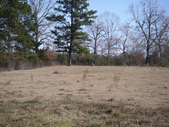
So, work an eight-hour day that involves walking for miles and looking for sites while NOT digging shovel tests in meter-plus deep sandy soils beneath 5-10 centimeters of pine needles and leaf litter (as we say "looking for a piece of hay in a needle stack"). Then, come home and put out small fires and apologize to crew members who got yelled at TWICE and let the clients know what we did today and plan out the next days work. Yeah, I have time to blog about it, but it's exhausting!
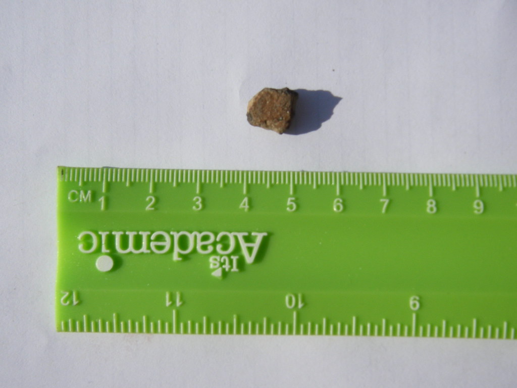
On the plus side, I did actually find a pretty nice dart point base in a dirt road.

Labels: , , , , ,

Sunday, January 11, 2009

Another state of mind

So I drove up to Shreveport, Louisiana today for a weeklong reconnaissance survey project. This is my first time actually doing fieldwork in Louisiana, although I've been to Baton Rouge a couple of times to do background research.
Not only is this my first time working in Louisiana, but I am actually the field director for this job, overseeing 5 crew members. This is my first time as a field director, so I'm a little nervous. OK, very nervous, as this is something of a test. This isn't exactly a normal project, although now that I think about it I'm not exactly sure what a normal project is. It's going to require a lot of flexibility and improvisation. Fortunately, the months spent on the Keystone pipeline project definitely required plenty of those things.
The work is being done for a seismic survey. Their project area is 165,000 acres. We did a background review which identified all of the previously recorded sites in the area. We also identified the High Probability Areas based on the sites, soils, geology and drainages in the area. We gave this to the client to develop an avoidance plan. Unfortunately, there were still 20,000+ acres of HPA, which was too much for the client to avoid impacts, and too big to survey effectively. The Louisiana SHPO wasn't very specific about what to do, so we worked with the client to develop a workable plan. We identified 10 areas within the HPAs that had the highest probability of having significant sites (basically, the areas most likely to have Caddo sites), and will survey those. We will also revisit the potentially significant previously recorded sites to make sure that the recorded site boundaries are correct, to assist in avoidance.
Now, the kicker. There's some obstructionist contractors (I guess with at least some say over how work is conducted) who have been very difficult. They freaked out at the idea of shovel testing. I don't exactly understand why, something about landowners withdrawing their access (I can't remember if I've blogged before about landowners misunderstanding of cultural resources laws, who fear that the government will take their land if we find a site). So we're not doing any shovel tests, only examining ground surface and exposures. They also are uncomfortable with the concept of the HPAs. However, somehow, they were cool with everything when it was explained as "places where sites were found but not properly recorded." So that's how we're selling that.
Honestly, this isn't really how cultural resources management should be done, and none of us are really comfortable with the process. On the other hand, it makes for very easy field work if one can compartmentalize and look at it as "At least we're doing something."
Oh, last thing to mention before I turn in for the night. Almost all of this has happened (except the original background review and avoidance plan) since last Wednesday.

Labels: , , ,