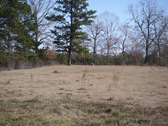
Look, it's a site!
That's me sitting on a nice sandy ridge that surely contains some awesome buried deposits related to site 16DS277. The photo was taken from the pipeline corridor, in the location that the site was originally documented. The recorder noted that the site likely continued onto this nice ridge, however, he was limited by the APE. One of our primary goals during the survey in Louisiana was to try and ground truth the site boundaries for the potentially significant sites. Many recorded sites have indeterminate boundaries because of the survey limits, but this isn't necessarily reflected on the topographic quad maps that are used by state agencies to record site locations.
In our case, our main limitation as far as chasing sites was the property boundaries and permitted areas. However, the restriction placed by the "no shovel test" rule, combined with the thick pine needle and oak leaf litter ground cover, meant that we couldn't really ground truth sites very well. This site was an exception because, as you see, it's been cleared and is used as pasture. In the background, however, you will notice a wall of short trees that is a pine timber farm. The site likely extends back there as well, as the ridge continues, but we had zero visibility. I used the fence line as my new site boundary on the GPS.
We actually found some artifacts here as well (photos on the Flickr page or just click below). The area along the fence line had undergone some erosion, which left a narrow linear exposure. I found a small, brushed, sand-tempered ceramic sherd and a tested petrified wood cobble in this area. There were also extensive gopher mounds on the ridge, and I found a grog-tempered, incised ceramic sherd on one of those. That doubled the artifact count from the week of survey.
Last Friday ended up being the last field day, due to limited access to two of our HPAs and two of our sites. We even got done a little early and grabbed some lunch at a gas station/cafe in Keatchie (rhymes with Peach Guy). The lady at the cash register asked if we were with the pipeline, and I told her that we were with the seismic survey. She replied, "Oh, the intellectuals" and laughed, and I smiled and nodded. She mentioned that they were glad to have us out there, because we were helping a lot of people out. That made me feel really good after all of the other nonsense involving landowners.
On a totally unrelated note, I was looking at a link on Colleen's awesome blog (and if you read mine, you probably already read hers, and probably read it first. If you don't, read it because she's out on the academic forefront of archaeology and technology). Turns out that I made a Top 100 Anthro Blog list. I'm sometimes interesting! I'm inclined to agree. Thanks for the kudos!
Labels: archaeology, archeology, Caddo, Flickr, Louisiana, site, survey


1 Comments:
There's gotta be a snake laying around waiting for you.
I owe you money.
roo
Post a Comment
<< Home